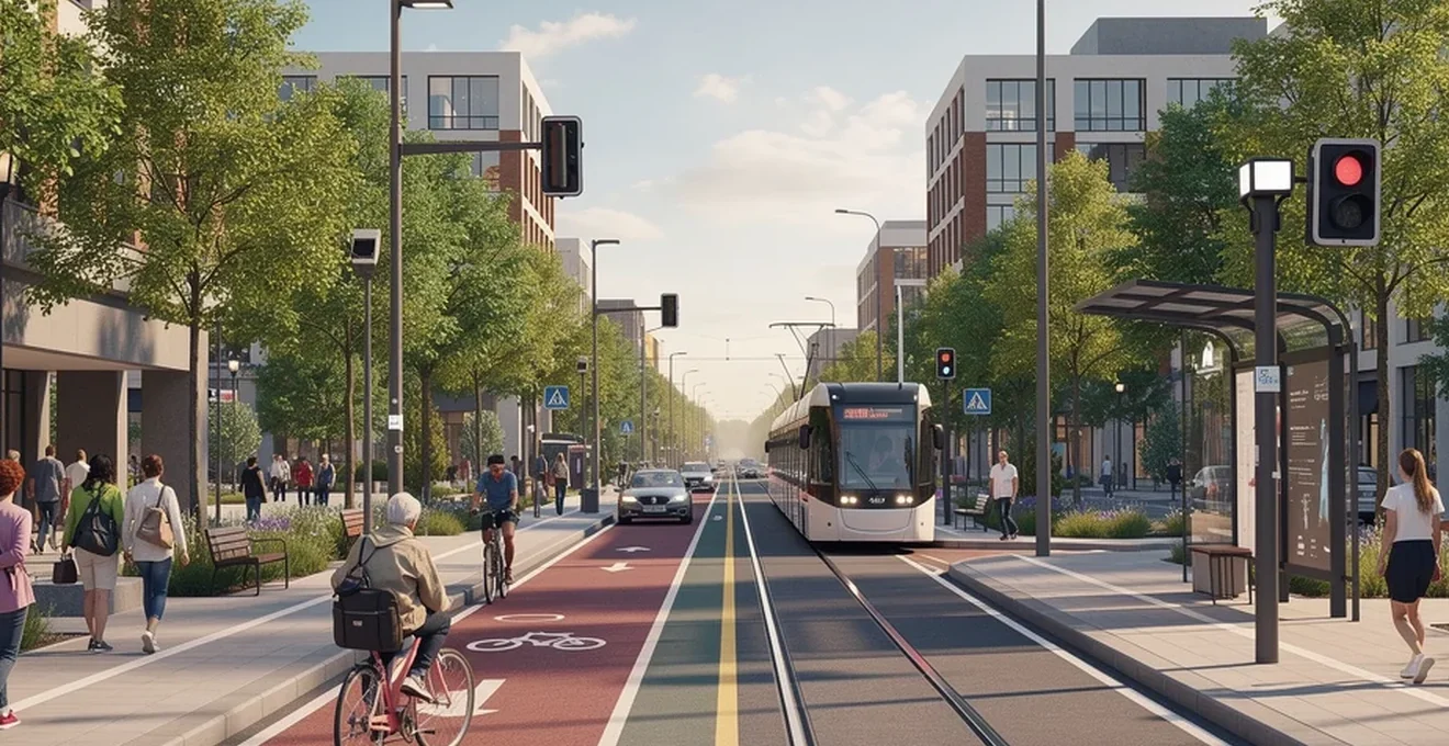
Cities are shaped as much by their public spaces as by their skylines. Streets, parks, transit hubs and libraries are not decorative extras; they are the connective tissue that determines whether residents feel a sense of belonging, whether they walk or drive, and whether they trust their neighbours. Research into social infrastructure has shown that well-maintained public spaces help people forge friendships, build civic trust and reduce loneliness, while poorly funded or fragmented spaces leave communities isolated. Making cities genuinely people-friendly requires more than good intentions: it demands deliberate design principles, engineering choices, transit planning, green infrastructure, accessibility standards and, increasingly, digital tools. This article examines the frameworks and technical approaches that underpin liveable, inclusive urban environments, from Jan Gehl’s human-scale design philosophy to smart city sensor networks.
Human-centred urban design principles shaping liveable cities
At the heart of people-friendly urbanism is a simple idea: cities should be designed for the people who live in them, not solely for the vehicles that move through them. Human-centred design prioritises the experience of walking, lingering, meeting and playing over the efficient throughput of traffic. This shift in thinking has produced several influential frameworks that continue to guide planners today.
Jan gehl’s « life between buildings » framework
Danish architect Jan Gehl argued that the spaces between buildings—streets, squares, courtyards—matter as much as the buildings themselves. His framework distinguishes between necessary activities (commuting, shopping), optional activities (sitting, strolling), and the social activities that only occur when the first two are supported by comfortable, well-designed public realm. Where streets are hostile to pedestrians, social life withers; where they are calm, shaded and furnished with seating, people linger and interact. This principle underlies much of contemporary placemaking and explains why cities investing in seating, greenery and slower traffic tend to report higher levels of social contact and neighbourhood attachment.
The 15-minute city model pioneered by carlos moreno
French-Colombian scientist Carlos Moreno popularised the concept of the « 15-minute city », in which residents can meet most daily needs—work, shopping, healthcare, education, leisure—within a short walk or cycle of home. The model reduces reliance on cars, cuts commuting time, and supports local economic activity by keeping footfall within neighbourhoods. It also reinforces social cohesion, since residents are more likely to encounter familiar faces at nearby shops, schools and parks than in car-dependent, dispersed urban layouts.
Placemaking strategies from project for public spaces
Placemaking approaches, championed by organisations such as Project for Public Spaces, treat community input as central to designing successful public areas. Rather than imposing top-down solutions, planners work with residents to identify what a space needs—shade, seating, play equipment, market stalls—and test lighter, quicker, cheaper interventions before committing to permanent infrastructure. This mirrors findings from symposia on public space design, which stress that creating places « for and with the people » builds a sense of ownership, safety and belonging, particularly in lower-income communities where public space may double as a site of livelihood and informal commerce.
Walkability metrics and walk score methodology
Quantifying walkability helps planners and residents compare neighbourhoods and identify gaps in pedestrian infrastructure. Walk Score-style methodologies typically assess proximity to amenities such as groceries, schools, parks and transit, combined with measures of street connectivity and pedestrian safety. These metrics are useful diagnostic tools, but they work best alongside qualitative observation—since a numerically « walkable » area can still lack shade, seating or safe crossings, all of which affect whether people actually choose to walk.
Pedestrian infrastructure and traffic calming engineering
Human-centred design principles only translate into liveable streets when supported by concrete engineering measures that slow traffic, protect pedestrians and reclaim road space for people.
Woonerf shared street design from the netherlands
The Dutch woonerf, or « living street », removes the conventional separation between pedestrians, cyclists and vehicles, instead creating a shared surface where cars must travel at walking pace. Design cues—raised surfaces, planting, informal parking, a lack of kerbs—signal to drivers that they are guests rather than the priority user. This approach has since spread across northern Europe as a model for residential streets where social use is as important as movement.
Barcelona’s superblocks (superilles) programme
Barcelona’s superblock programme groups several city blocks together and restricts through-traffic to their perimeter, freeing the interior streets for pedestrians, cyclists, play and community events. The scheme aims to reduce noise and air pollution while creating new public space without demolishing existing buildings, illustrating how traffic management itself can function as a form of social infrastructure investment.
Curb extensions, chicanes and speed table implementation
Smaller-scale traffic calming tools remain essential complements to larger schemes. Curb extensions (or bulb-outs) shorten pedestrian crossing distances and improve visibility at junctions. Chicanes introduce curves into otherwise straight roads, discouraging speeding. Speed tables—flat-topped raised sections of road—slow vehicles without the abruptness of a standard speed bump. Deployed together, these measures lower vehicle speeds and reduce collision severity, making streets more inviting for walking and cycling.
Copenhagen’s segregated cycle track network
Copenhagen’s cycling infrastructure is built around physically separated cycle tracks, distinct from both the carriageway and the pavement. This segregation reduces conflict between cyclists, pedestrians and motor vehicles, and has been central to the city achieving very high rates of everyday cycling. The network’s consistency—continuous, well-maintained routes rather than fragmented lanes—is often cited as the key factor behind its success, reinforcing the broader lesson that piecemeal infrastructure struggles to shift travel behaviour at scale.
Public transit systems and multimodal connectivity
Streets designed for people must connect to transit systems that offer genuine alternatives to private car use. Multimodal connectivity—linking walking, cycling and public transport seamlessly—is what makes car-free living practical rather than aspirational.
Bus rapid transit models: curitiba’s TransMilenio legacy
Curitiba, Brazil, pioneered the modern Bus Rapid Transit (BRT) concept, using dedicated bus lanes, pre-boarding fare payment and tube-style stations to replicate metro-like speed and reliability at a fraction of the cost of rail infrastructure. The approach was later adapted and scaled in Bogotá’s TransMilenio system, and BRT has since become a widely used tool for cities seeking high-capacity transit without the capital expense of underground rail.
Transit-oriented development around metro stations
Transit-oriented development concentrates housing, retail and employment within walking distance of rail or metro stations, reducing car dependency and supporting the ridership needed to sustain frequent services. Done well, it creates compact, mixed-use neighbourhoods where daily errands, work and transit access are all within easy reach—echoing the same logic underpinning the 15-minute city model.
Tokyo’s integrated Rail-Pedestrian interchange design
Tokyo’s major rail stations function as multi-layered interchanges, integrating pedestrian walkways, retail, cycle parking and multiple transit lines within a single, carefully sequenced space. The emphasis on smooth pedestrian flow—clear sightlines, minimised level changes, generous concourse widths—demonstrates how transit infrastructure itself can be designed with the same human-centred principles applied to streets and public squares.
Green infrastructure and sustainable public realm planning
Public space is not only about movement and gathering; it also performs essential ecological functions, from managing rainwater to cooling overheated streets.
Singapore’s park connector network
Singapore has developed an extensive network of park connectors—linear green corridors that link parks, waterways and residential areas, allowing pedestrians and cyclists to move between green spaces without needing to use main roads. The network extends the benefits of parks beyond their boundaries, effectively weaving nature into everyday commuting and leisure routes across the city.
Sustainable urban drainage systems (SuDS) application
Sustainable Urban Drainage Systems manage rainwater close to where it falls, using permeable paving, swales, rain gardens and detention basins rather than relying solely on piped drainage. This reduces flood risk, filters pollutants before they reach waterways, and often doubles as attractive green public space, aligning environmental performance with everyday amenity.
Urban heat island mitigation through tree canopy cover
Dense urban areas with extensive hard surfaces and limited vegetation experience the urban heat island effect, where temperatures run significantly higher than in surrounding rural areas. Expanding tree canopy cover provides shade, lowers surface and air temperatures through evapotranspiration, and improves comfort for pedestrians. Given growing concern over extreme weather, resilient public space design—shaded seating, tree-lined streets, and greened public squares—is increasingly treated as a core infrastructure priority rather than a cosmetic add-on.
Universal accessibility and inclusive design standards
A people-friendly city must work for all people, including those with disabilities, older residents and children. Inclusive design standards translate this principle into practical, enforceable requirements.
Tactile paving and wayfinding systems for visually impaired users
Tactile paving—raised patterns underfoot—alerts visually impaired pedestrians to hazards such as kerbs, crossings and platform edges. Combined with clear, consistent wayfinding signage and audible crossing signals, these systems allow independent navigation through complex urban environments, reducing reliance on assistance and expanding genuine access to public space.
Compliance with ADA and BS 8300 accessibility codes
In the United States, the Americans with Disabilities Act (ADA) sets minimum requirements for accessible design in public infrastructure, covering ramps, door widths, signage and more. In the United Kingdom, BS 8300 provides equivalent guidance on designing buildings and their approaches to be accessible for disabled people. Compliance with these codes is a baseline rather than an aspiration; genuinely inclusive public space typically exceeds minimum standards, incorporating accessibility from the earliest design stages rather than retrofitting it afterwards.
Age-friendly city frameworks by the world health organization
The World Health Organization’s Age-Friendly Cities framework encourages planners to consider the needs of older residents across outdoor spaces, transportation, housing and social participation. This includes features such as sufficient seating at regular intervals, longer pedestrian crossing times, and accessible public toilets—design choices that also benefit parents with young children and people with temporary mobility limitations, illustrating how age-friendly planning tends to produce broadly inclusive outcomes.
Digital infrastructure and smart city integration
Physical infrastructure increasingly works alongside digital systems that monitor, manage and adapt urban environments in real time, offering new tools for improving liveability.
Barcelona’s sentilo sensor platform for urban data
Barcelona’s Sentilo platform is an open-source sensor network used to collect and share urban data, from environmental monitoring to infrastructure management. By making data openly accessible, the platform supports evidence-based decisions about where public services and interventions are most needed, and allows different city departments to draw on a shared information base rather than working in isolation.
Adaptive traffic signal systems using IoT technology
Adaptive traffic signals use Internet of Things sensors to adjust light timings in response to real-time traffic and pedestrian flow, rather than relying on fixed schedules. This can reduce vehicle idling and emissions while also allowing pedestrian crossing times to be extended dynamically at busy periods, supporting safer, more responsive streets that continue to prioritise people alongside vehicle movement.